Conquering Kilimanjaro
In our minds we’ve split our time in Tanzania into two main parts. The first section focused mainly on the wildlife, which was a mixed bag. It was exorbitantly expensive but we managed to share some amazing moments with nature. We’re now entering the second, more challenging, phase. Climbing Mount Kilimanjaro, the highest point in Africa and the world’s highest freestanding mountain.
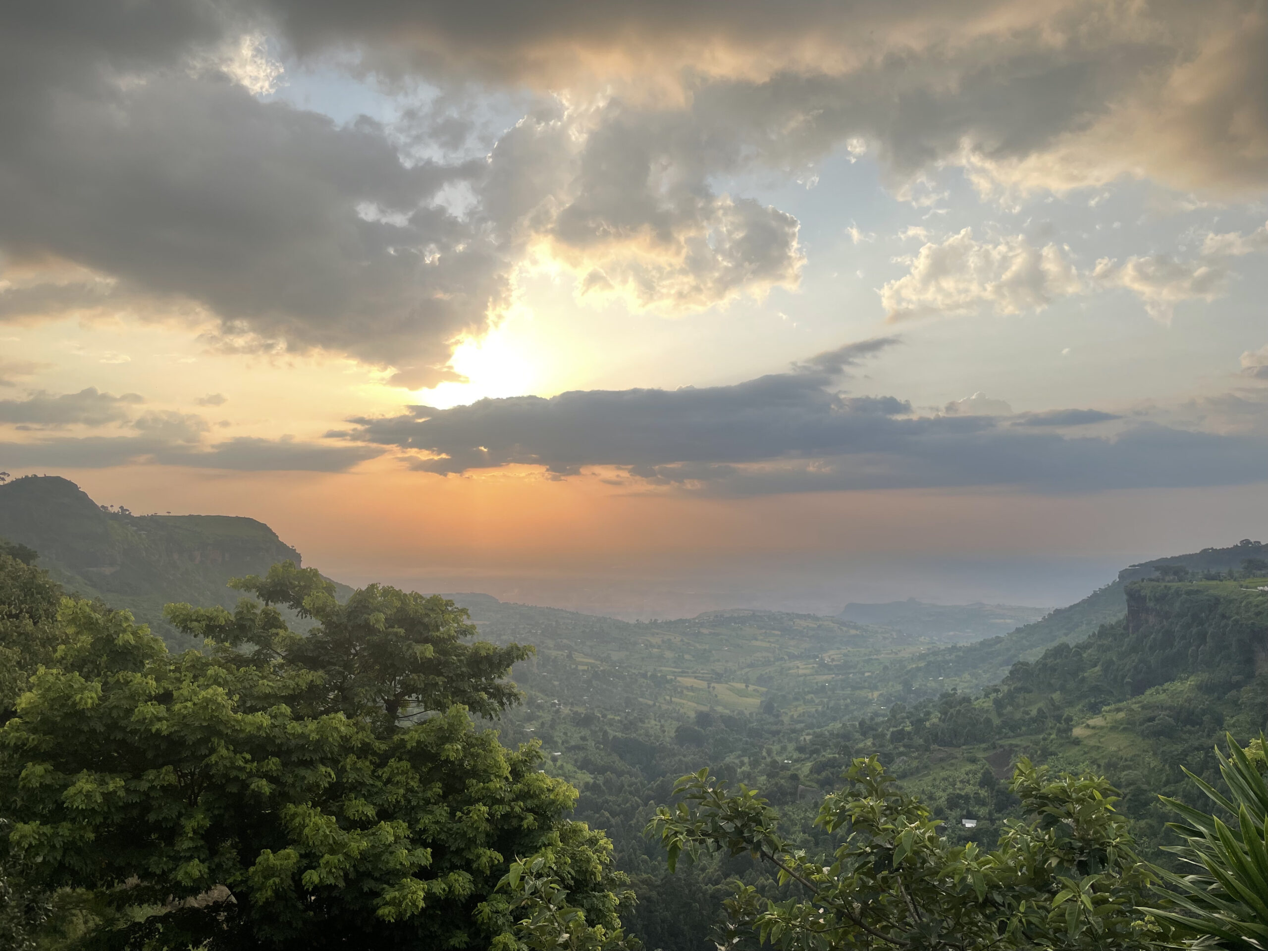
After three days staying in the small town of Karatu, overlooking rolling terraced hills, we’ve driven on to Arusha. It’s a large bustling town used as the base for most Kilimanjaro expeditions. It sits at an elevation of around 700m above sea level and has no real tourist sites itself per se. It sits under the imposing shadow of Mount Meru, which upon arrival we stupidly mistake for Mount Kilimanjaro. We get out the car, smiling at each other, and take some photos and discuss how it looks eminently doable. How naïve. It’s more than 1300m shorter than Kilimanjaro. That’s the height of the UKs highest mountain, Ben Nevis.
Our expedition is due to start in two days. We arrived a few days early to give us time to clean our clothes and rent any additional equipment. There’s also a rather unusual stop we’ve been asked to make first by one of my wife’s friends. She is of Polish descent and her grandma, or ‘Babcia’, is sitting back in Northamptonshire in the U.K. in her 93rd year, however, her mother’s grave is here in Tanzania. It’s a fascinating, but sad and sobering, historical story that we learn more about when we visit the cemetery for Second World War Polish refugees. As we pull up to the cemetery, about 45 minutes drive east from our hotel, our hearts sink, the front gate is padlocked. As we get out of the car to peek through the bars an elderly man called Joseph walks over and introduces himself. He explains that his father was responsible for tending to the cemetery from its inception post World War II. Joseph then took up the mantle when his father could no longer continue. To our relief, he pulls out a key and unlocks the gate.
On the left row towards the end of the graveyard we find the grave of Babcia’s mother, Karolina Radon, born February 1902, died March 1945. Karolina was one of thousands of Polish people that were transported into the depths of the USSR after Stalin signed the secret Molotov-Ribbentrop pact in 1939 with Nazi Germany. It was a deal to divide Poland and enslave the Polish people. Many were transported to manual labour camps in parts of the former Soviet Union like Kazakhstan. Two years later, when the USSR declared war with Germany, Stalin wanted Polish support. Consequently, the labour camps were quickly emptied. Many Polish people eventually reached East Africa, having had to travel at length through Iran and Iraq. Sadly, Karolina succumbed to Malaria shortly after she arrived in Tanzania, or the British colony of Tanganika as it was called at the time. The cemetery itself is beautifully maintained. It’s surrounded by a high white stone wall with banana and plantain trees towering up over the sides. There’s not a weed in sight and the graves, each marked with either a Jewish star or a Christian or Orthodox cross, sit in eight neatly manicured rows.
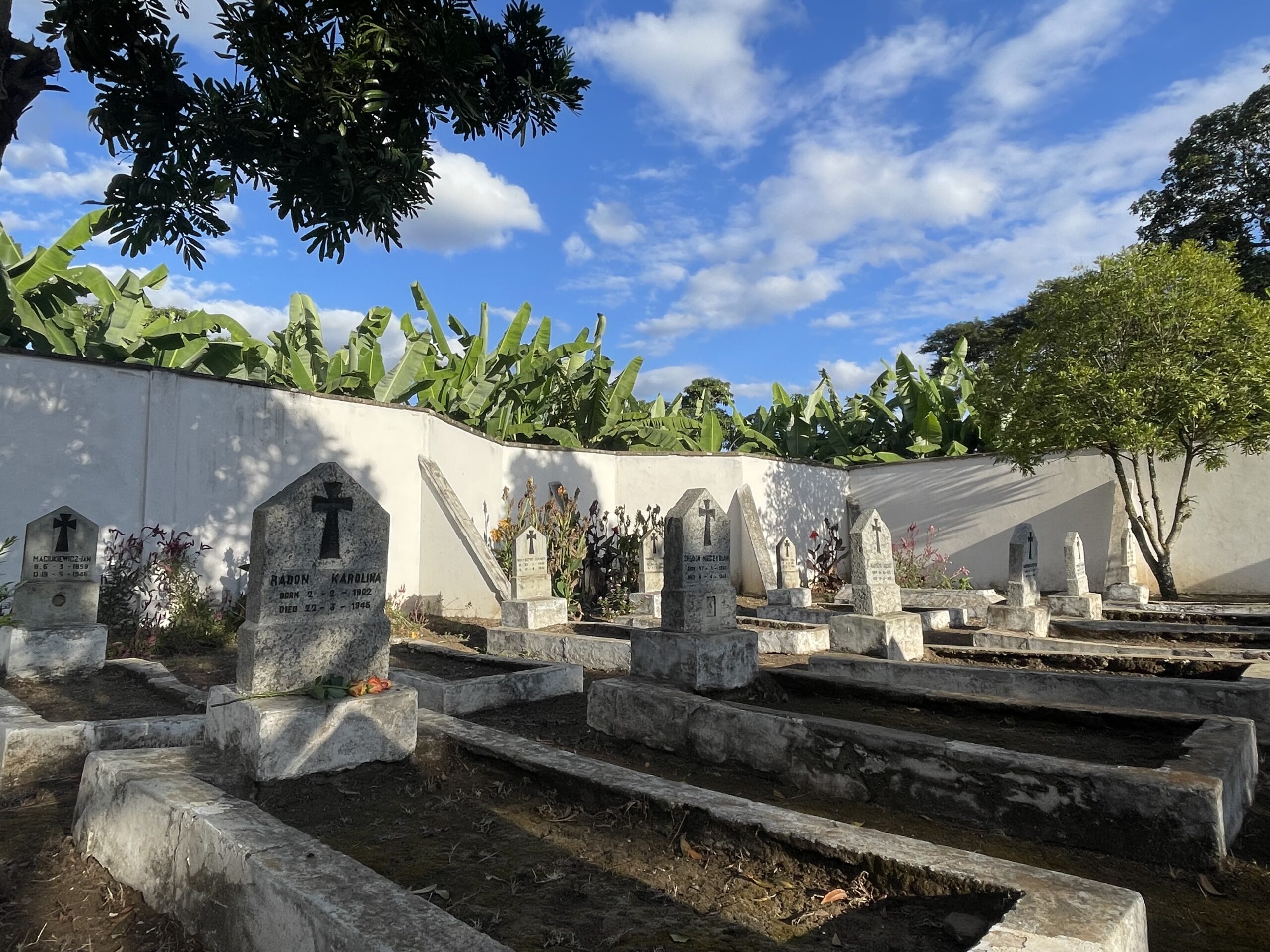
(Polish refugee war cemetery, Arusha, Tanzania)
We spend an hour reading the information available and talking with Joseph. It’s an unexpected highlight, and my wife sends pictures and videos to her friend to show to her Babcia, Karolinas daughter, back in the U.K.. We’d already enjoyed the visit and learning this little known piece of history, but when we hear Babcia being shown the pictures on a voice note two days later it’s truly moving. She’s never been able to visit her mother’s grave since leaving. She says she’s happy about the banana trees, she’s always loved bananas.
Back in Arusha later that day we take the opportunity to get massages at a small, very clean and professional spa on a dirt back street. It’s well worth it and probably the cheapest massage I’ve had since a male masseuse fell asleep on me in the Philippines five years before (true story), thankfully here the service was much better.
The next day we say goodbye to our trusty rental car (the first one wasn’t so trusty and didn’t make it out of Uganda). It’s taken us through ravines, over riverbeds, across barren plains, and down dull motorways as we’ve navigated three countries. In the late afternoon we meet our two expedition guides for the first time, Angela and Omari. They take us into the centre of town to pick up some essentials from a rental shop, including sleeping bags and climbing poles. We select our sleeping bags carefully, making sure they’re the thickest of the options available.
Day 1
The expedition begins. We start by stripping our backpacks down to only those items needed for the trip and leave the remnants at the hotel reception. We’re collected in a minivan with the roof stacked precariously with supplies. Inside it’s jam packed with our team of 13 people (yes, you read that correctly). There’s our two guides, our chef, Idris, and our ten porters Solomon, Wilson, Arafat, Rashidi, Yasidi, Joanna, Ashraf, Pascal, Shabani and Evance. We drive northeast for around 2 hours towards the mountain, although we can’t actually see it. We start to wonder if it really exists, but it’s just shrouded in dense low hanging cloud. We stop briefly to enable the porters to have a late breakfast before driving on to the Lemosho entry gate at the higher elevation of 2100m.
We’re given our packed lunches and sit talking with the other hiking groups about the length of their trips and the various routes. Meanwhile, our porters are left to individually weigh each bag. We ask about the maximum they can carry and our guide Omari explains that each porter can take a maximum of 20kg, normally carried on their heads, but he says it hasn’t always been that way. He’s full of horror stories, having himself once had to carry over 35kg and also not been fed at the higher elevations due to intentional cost savings by shoddy tour operators. Once he wasn’t paid when he got back down the mountain, but, as he’s keen to stress, things have thankfully improved. He says the company we’re using (Local Crew) is one of the good ones and pays all its staff the amounts recommended by the Kilimanjaro National Park Authority. It’s something that was important to us and we (my wife Jess entirely) had checked before booking. By the end of lunch Jess has already befriended a lovely lady in a colourful bomber jacket called Neha. She’s planning to celebrate a milestone birthday at the top of the mountain. After lunch we pack up, say our goodbyes, and start the climb.
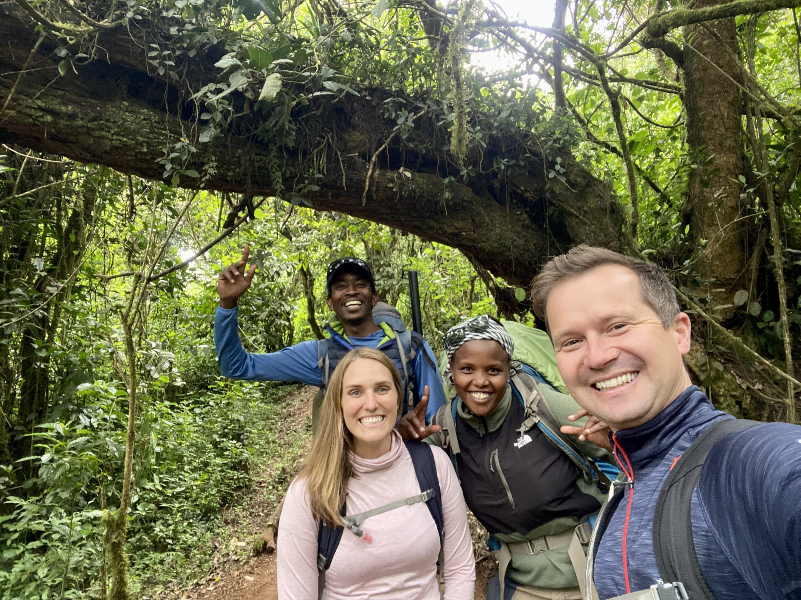
(Myself, Jess, and our guides Angela and Ommy at the start of the trek in mountain rainforest)
We initially trek up through mountain rainforest where low mist hangs and moss dangles over the tree branches. Our guides point out flowers and plants unique to the mountain and explain why the summit is called Uluhru Peak rather than Kilimanjaro peak. It translates to ‘freedom peak’, because the newly created Tanzanian flag was planted firmly on top on the day of the nations independence in 1961. As we hike along our guide Angela keeps bending down to pick things up, when we ask her about it she shows us the sweet wrappers she’s been gathering. The trail is already remarkably clean. I always end up with my pockets full of plastic whenever I stroll along any beach, so I respect what she’s doing, especially give that carting it up a mountain is much more of a commitment than walking along a beach. Two hours and 7km later we arrive at Big Tree campsite at an elevation of 2650m. We’re covered in a fine dust from the hike on the dry trail. We get our first sight of our three tents, one to sleep in, one to eat in, and the final one for the small camping toilet.
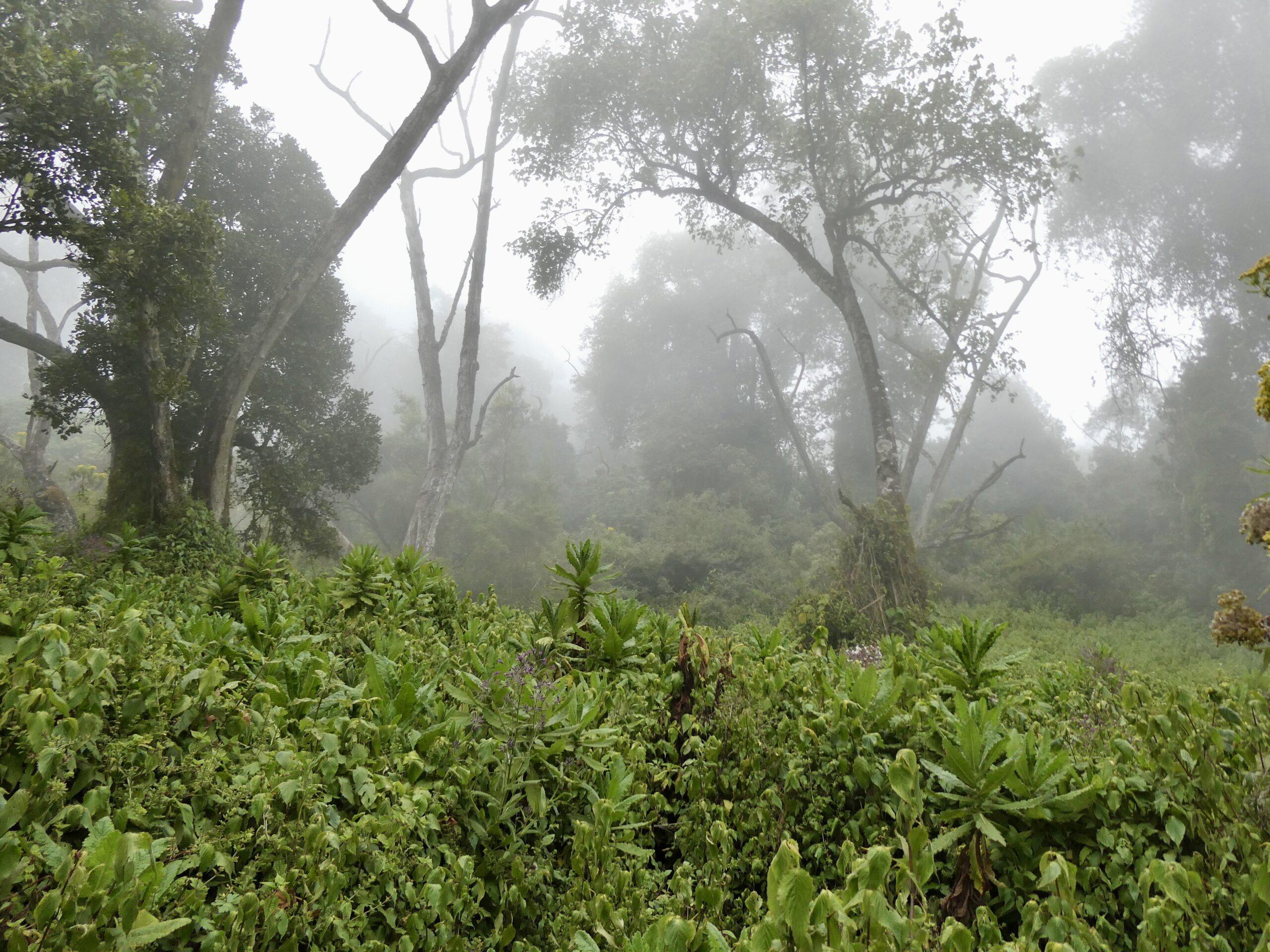
(Mist gathering in the rainforests at the lower elevations of Mount Kilimanjaro)
As you can probably tell, we’ve paid for a more expensive option for our climb. It’s 8 days long and private, costing around $2500 per person, so it’s just us and our support staff. We’ve chosen a longer tour because the success rate for reaching the top is much higher (close to 95%). We’ve read about nightmare situations when people try to climb the mountain too fast over 4-5 days. The success rate is below 50% for such attempts. For that reason we’re also taking Acetazolamide (Diamox), a medication designed originally to treat diabetes but repurposed off label to help reduce altitude sickness. It also helps you sleep at higher altitudes. As a result I have a fantastic nights sleep, way better than anything in the last few months, even though I’m sleeping on a thin ground mat and it’s close to freezing overnight. Jess, however, is not so lucky and has a restless nights sleep. Her inflatable pillow has a hole in it and she gets cold because, so she claims, I’ve stolen her sleeping bag. Amazingly, my pillow, along with my sleeping bag, immediately become hers. I’m left with my clean clothes shoved in a dry bag as a pillow alternative. True love at altitude.
Day 2
Over breakfast the next morning I notice I have slight pins and needles in my hands and toes. I’m worried it’s something to do with the altitude, even though we’re still quite low. Reassuringly, the guides explain that it’s just a mild side effect some people get from the Diamox, which is a relief.
Just as we get ready to set off, I see that the bags that were checked for weight at arrival at the camp are each around 20kg, but in fact each porter is still wearing a backpack on their backs. Confused, I ask our guides why. It turns out that the 20kg is in addition to their own belongings, which must weigh at least another 10kg and is typically in a 50L rucksack. It’s an incredible amount of weight combined. Unbelievably, they race along the path overtaking us as we continue our climb through misty mountain forest as colobus monkeys call in the distance. As the day progresses the terrain transitions into moorland and the height of the plants drops from a high forest canopy down to head height.
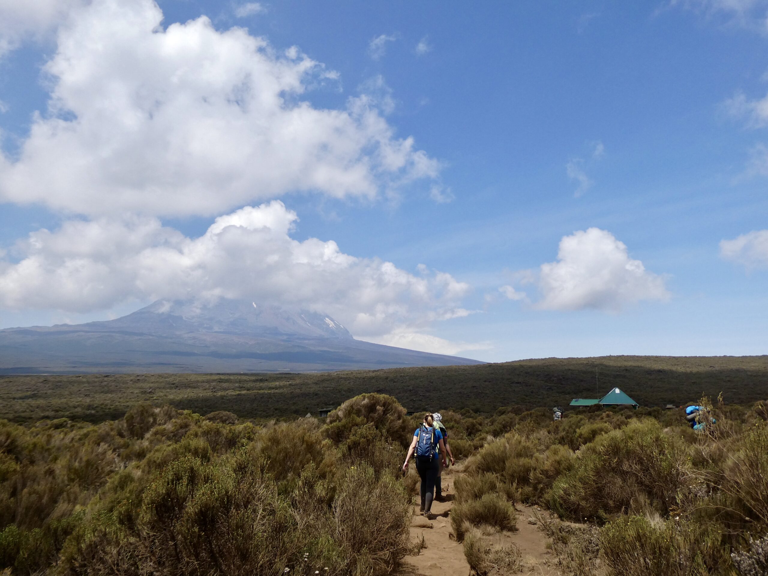
(Jess and Angela hike towards Shira One Camp with Ulhuru Peak in the distance)
Finally, the clouds clear and we get our first view of the peak, having seen nothing of the mountain the previous day due to cloud cover. Although it’s great to see it, the sun beats down relentlessly as we hike. I hadn’t expected this but on reflection it’s fairly obvious that there’s little to protect you once you’re above the clouds and into thinner air. As we move on we pass a couple we met at the start, the man is clearly not enjoying the hike. He says he barely slept, has a bad headache and his stomach is causing him problems. He’s not taking Diamox, which is something I’ve had mixed feelings about. In one way, I wanted to make the climb without it to prove I could, but in another way you can’t easily train for high altitude at sea level. Getting altitude sickness is not necessarily a reflection of your physical health. Often smokers actually suffer less because their lungs are used to the struggle. At this moment I’m happy I’m taking it. We don’t see them again for the rest of our climb, so I’m not sure if he improved. After 7km we end the day at Shira One Camp at an elevation of 3610m. It’s taken us 5 hours but it wasn’t difficult hiking and we ate lunch on the way. When we arrive at camp we are provided hot water for ‘washy washy’ as they call it. There are no showers on this route up the mountain.
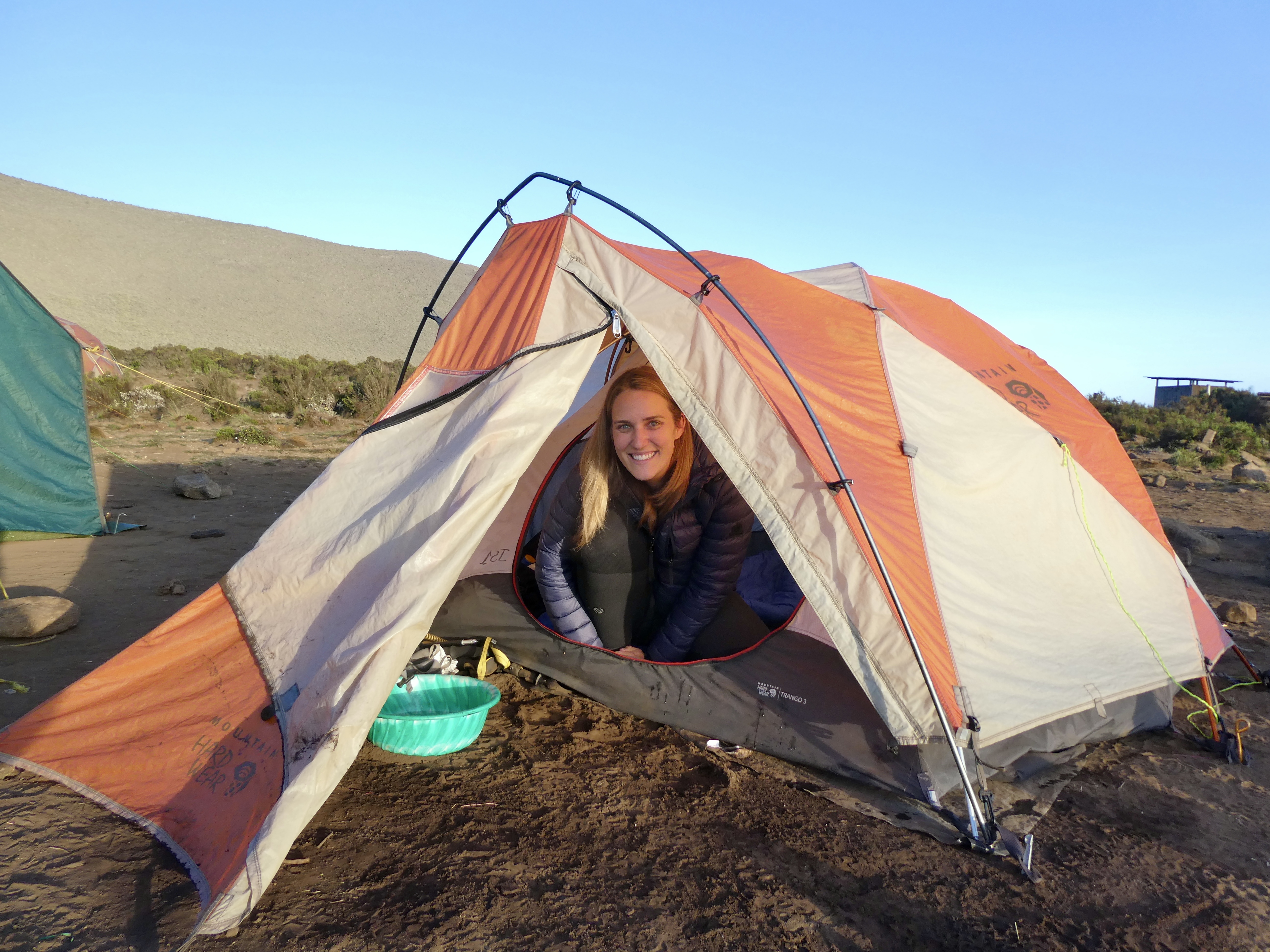
(Jess prepares for ‘washy washy’ in the tent at Shira One Camp)
It’s a standing joke with some of my friends that I can geolocate a KFC in most cities through a subliminal sixth sense. For dinner we are served ‘Kilimanjaro Fried Chicken’, and I’m not disappointed. It’s been cooked by our chef Idris on a small camping stove in the cooking tent in a pan of oil. The cooking tent also serves as the place where all the porters sleep. They cook with the entrance flaps closed, it’s boiling hot in there, but they all sit around laughing and joking, carbon monoxide the least thing on their minds.
(Idris prepares dinner in the cooking tent, which also doubles as the porters bedroom)
My wife Jess insists that I also mention the amazing soup and lovely vegetable stew we ate with the chicken, but really, what’s the point when you’ve got fried chicken. As the sun drops I sit happily in the last of its warmth reading an Inspector Rebus novel as the temperature begins to plummet around me. As I glance up at the peak, more than 2200m further up, I have a feeling of confidence that I’ll make it. It can’t be that hard, surely……
(Passing the time in view of the challenge ahead)
Day 3
We wake up to a cold morning with low hanging cloud. We try to get ready as soon as we can to give the porters time to get moving with our equipment on to the Shira Two Camp. The cloud quickly dissipates as the sun rises and we begin the 11km hike across the Shira plateau. It’s moorland with heather-like plants, but now most of the plants have dropped to waist height. There’s little to no trees or large shrubs. We cover the distance relatively quickly, taking only 3 hours but we only gain a few hundred meters, climbing to 3850m. This day is entirely about acclimatisation to the altitude.
After a few hours settling into camp we embark on a short afternoon hike to increase our elevation further, going up by approximately 300m. We wait there for 20 minutes and I build a cairn to sit alongside those that others have built. We then descend back down to camp to eat dinner, but not before Jess smashes my cairn to pieces, laughing as she scuttles away.
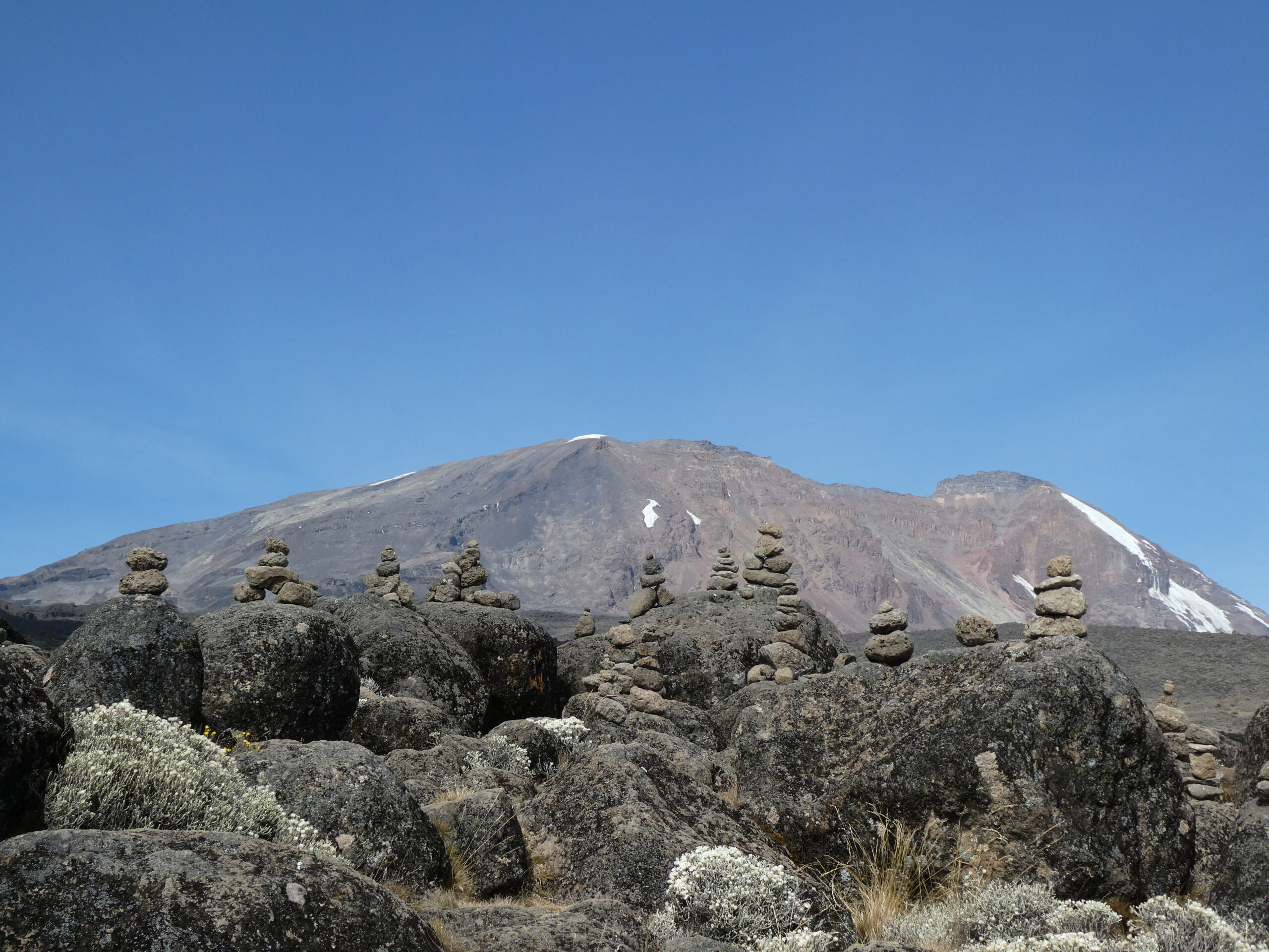
(Cairns built by previous hikers on the route to Ulhuru Peak)
Guess what’s for dinner? Yes, more KFC accompanied by a fantastic invention of egg combined with french fries in an omelette format. There are no bounds to human ingenuity.
Day 4
In the morning we join our guides for a quick briefing to discuss the day ahead. The mood has definitely changed as they talk about the plan, primarily because today we’re heading briefly up to an elevation of 4600m. They explain that at this elevation those clients that will struggle to summit will start to show significant signs of altitude sickness. We pack up and start the 7km hike up to our lunch spot, Lava Tower. The climb begins in moorland, but as we hike the plants reduce in height again until they reach around knee level. We’ve entered alpine desert. After 3 hours we arrive at Lava Tower, a large protruding rock sitting at the base of the main mountain at 4600m elevation. We take 1 hour to acclimatise and eat a packed lunch. Some people have full tents pitched for them, with tables, chairs and white cloths laid out for their arrival, but when we discussed this in the morning with our guides the idea seemed ludicrous. The porters would have to hike the lunch equipment up to 4600m only to then have to hike it down again to the lower elevation of our next camp, rather than them taking a shortcut at a lower elevation. We insist we can certainly survive with a packed lunch perched on a rock. Neither of us show any significant signs of altitude sickness, just mild and brief headaches. We then descend 3km down through mist and cloud, following a small mountain stream, to Baranco Camp at 3900m. This takes us around 90 minutes. The small amount of water from the stream, coupled with the mist in the air, allows the growth of plants we haven’t seen before. The path is flanked by mountain pineapples and some form of slow growing cacti. As we arrive at camp the mist clears and we get our first view of the Baranco Wall, the next days challenge.
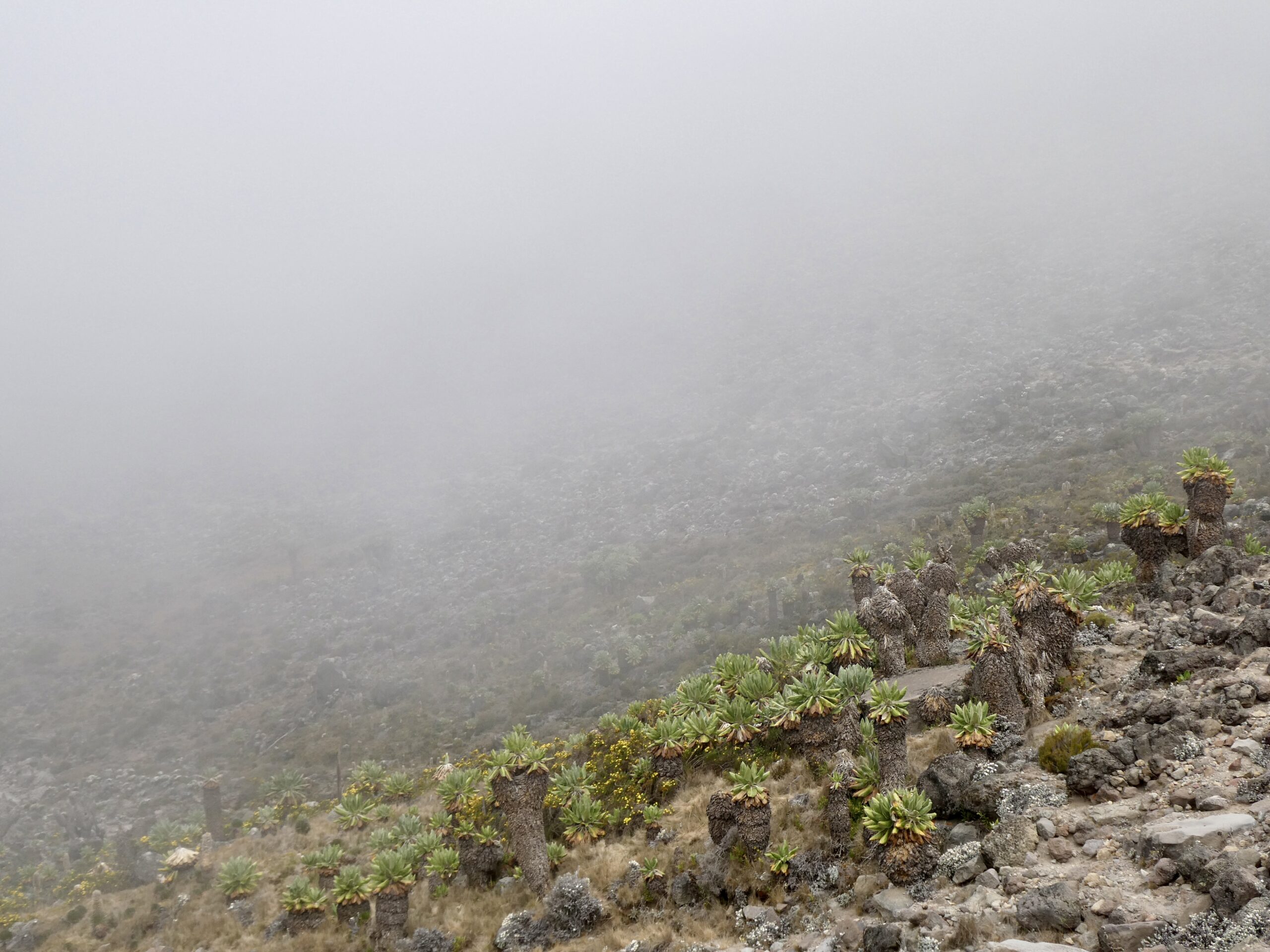
(Mist rolls up the side of the mountain, allowing plant life to grow at higher elevations)
Later in the day we learn more about the Baranco Wall which we will be climbing tomorrow. It’s about 300m high and climbs up from our camp to a plateau. We find out that the day before a porter fell off the wall and had to be airlifted out. Apparently he was in a very bad way and losing a lot of blood. It really doesn’t seem worth the risk to someone for just $10 a day, but here that’s a well paid opportunity. We don’t find out if he survived or not.
Day 5
The next morning we hike for 2km up the Baranco Wall to an elevation of 4200m through a series of switchbacks. It’s the only real bit of the climb that needs our hands to help and it takes about an hour.
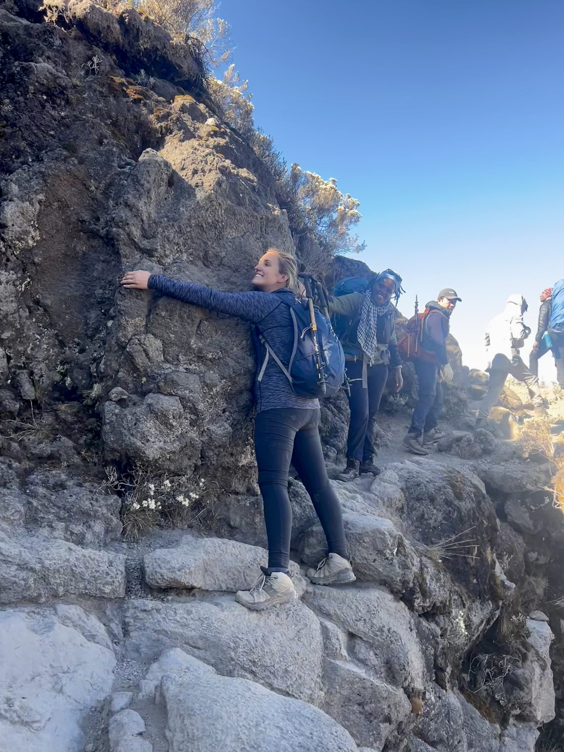
(Jess hugs the kissing rock on the Baranca wall with a 500m drop below)
Once at the top we hike a further 4km. We start the hike in moorland but end it in alpine desert, including a large burnt patch from the year before caused by a cigarette butt. Just before we climb up the last ravine to the Karanga Camp our guides explain that this is the last natural source of water before the summit. This means the porters will have to carry all the water needed from here for the next two days, and in fact some may have to come back down to collect more. As we reach the camp our final elevation is just below 4000m. That evening we can see the peak of Mount Meru in the distance poking above the clouds. The sunset over it is beautiful. It’s a surprisingly pleasant evening spent watching the mist roll up the mountain.
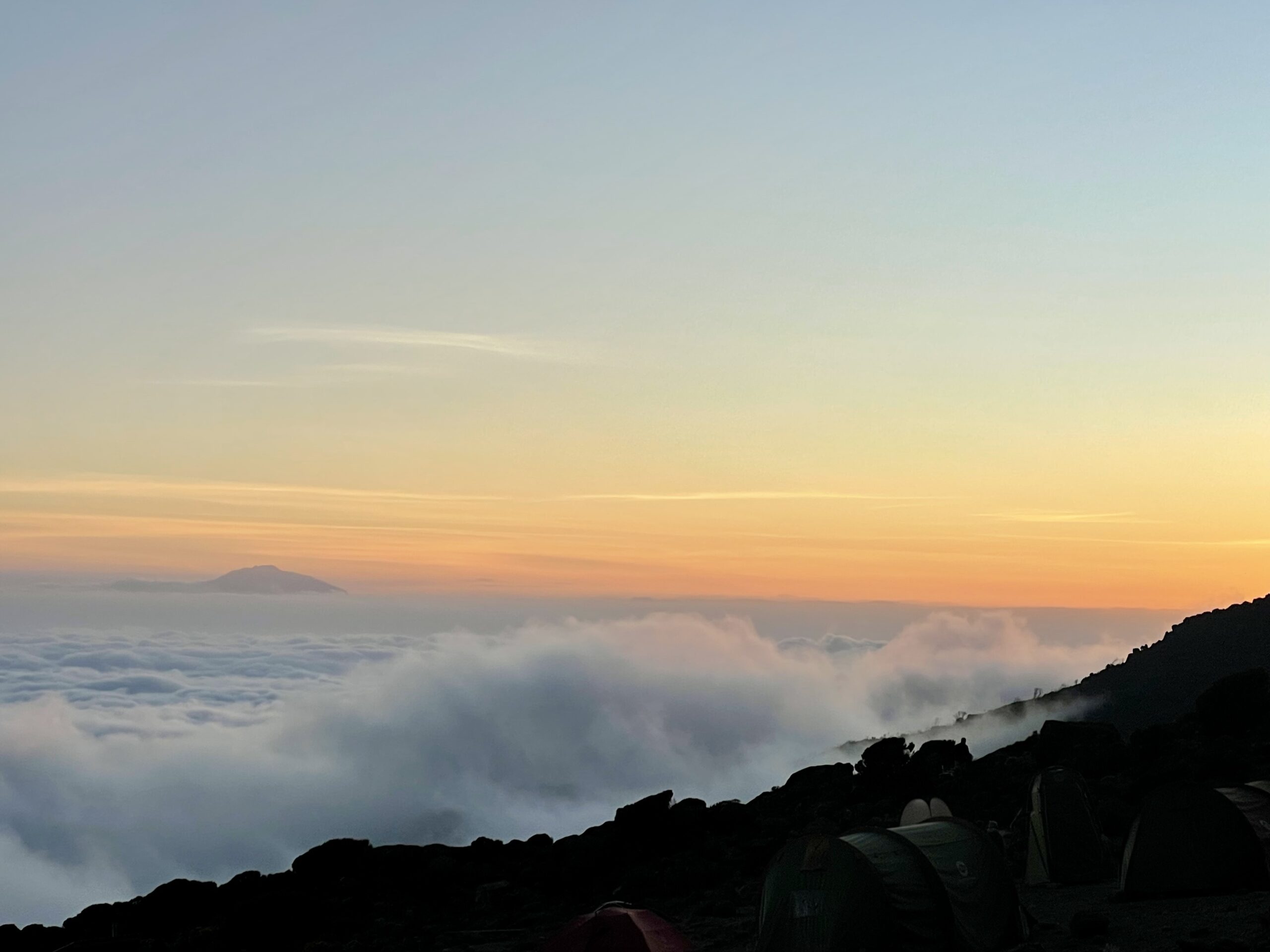
(Sunset from Karanga Camp with the peak of Mount Meru in the distance)
Day 6
The next day we ascend to Barafu Base Camp through more alpine desert. It’s a 4km hike and takes us about 2.5 hours. Our elevation increases from 3995m to 4673m. The word Barafu means ‘ice’ in the local language, apparently because it used to be covered in snow at the tail end of a glacier. Theres no snow in sight. Our guide jokes that when the snow goes from the very top, so does he.
Before we can eat our dinner there’s a delay to setting up the camp. Our spot is taken by another team who are waiting for their climber to descend from the summit. To my wife’s delight the climber is Neha, the lady she befriended right at the start of the climb. After catching up we say our goodbyes as Neha starts her descent. After an early dinner we try to get some sleep, we will be starting the summit ascent at midnight. Thankfully, we both sleep quite well and wake up feeling good. However, you can tell you’re at elevation now though because any physical exertion leaves you out of breath. If you’re lucky enough not to get altitude sickness, the effects of the elevation creep up on you slowly without you really realising it. Before you know it walking to the toilet tent 10 feet above your sleeping tent is a challenge.
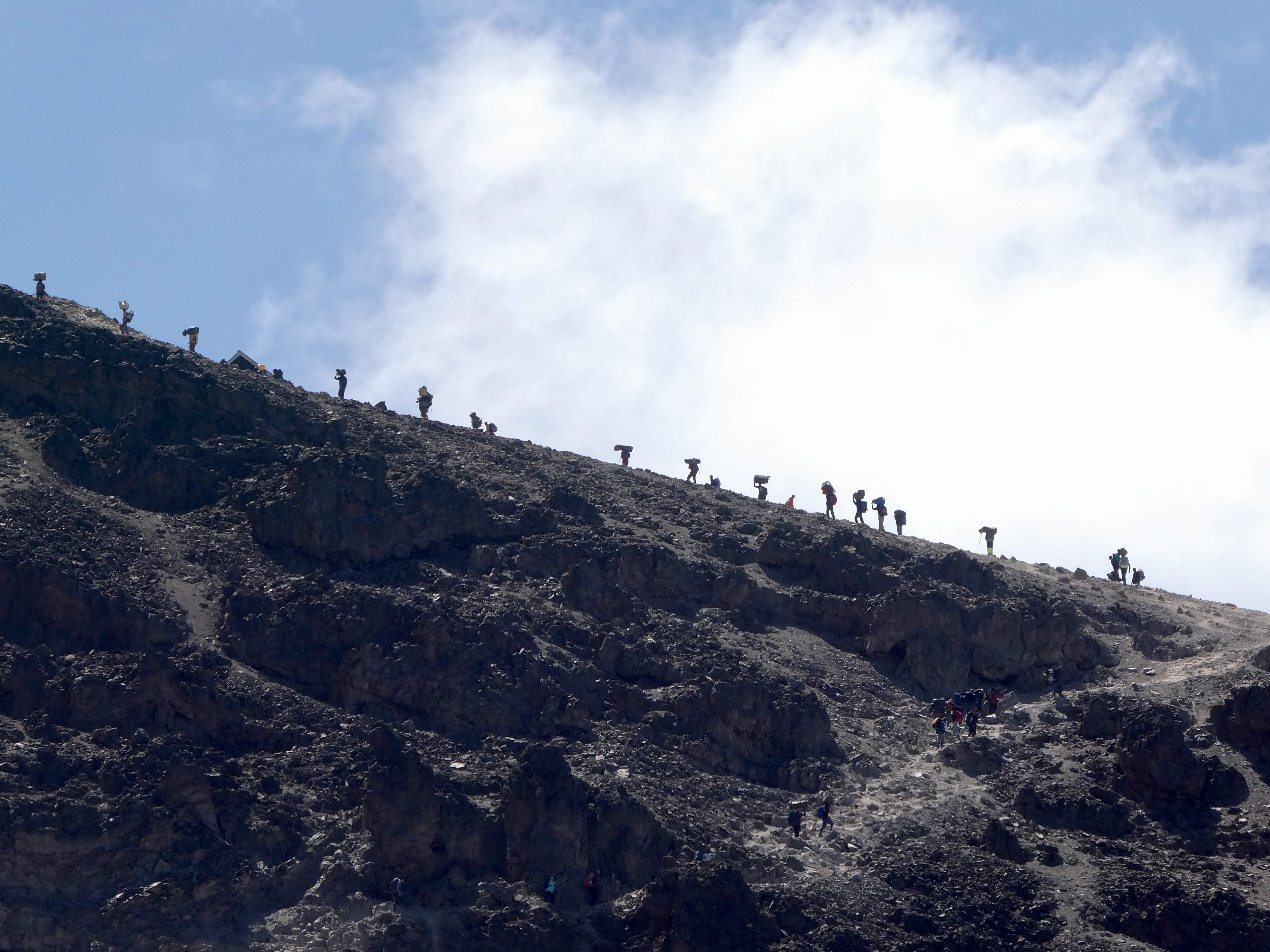
(Porters carry equipment along a ridge line up to base camp)
Day 7 – The Summit
We wake at midnight and eat a small breakfast and begin the hike to the summit at 12:40am. It’s bitterly cold and pitch black except for the stary sky and the thin columns of light from our head torches. We’re wearing literally everything we brought with us. Two pairs of gloves and socks, a woolly hat, thermals, trousers and salapetes. Multiple tops, a down jacket, and a waterproof coat. As we begin the hike it’s clear that this will not be easy. The climb starts at 4673m and we are heading up to 5895m. The oxygen percentage at the top is just under 10%, compared to the normal 20.9% at sea level. Above 5000m it’s called the arctic zone. Total distance from base camp to the top is only 6km, but after a few steps you can feel the tightness in your chest as you start to mildly exert yourself with the upward climb. Our guides Omari and Angela remind us that the key to summiting is ‘Poley Poley’ which when translated from Swahili means ‘slowly’. We are both told not to stop. Stopping means you get cold, and once that happens there’s no getting warm again.
The ground beneath our feet is comprised of a course black and grey sandy powder. Large dolomite boulders sit scattered either side of the narrow pathway. The trail starts straight but quickly becomes a series of switch backs as the gradient increases. As I look upwards I can see a snake of head torches winding slowly up the mountain. Most groups have set off earlier than us at midnight, but we’ve set off slightly later because our pace has been good for the previous days. We don’t want to reach the summit in the dark.
The first two hours pass slowly and without too much difficulty, but before I know it my head is down and I’m just focusing on the ground in front of me. The light from my head torch glistens against the quartz and obsidian on the gravel underfoot. I find myself becoming obsessed with certain thoughts that repeat over and over in my head as we slowly climb. I spend half an hour step after step thinking about how with each step I push gravel downwards, making the mountain ever so slightly steeper for those that will go after me. When I find it hard to carry on I remind myself just how much more I’m enjoying this compared to all the board meetings I sat through at work. It’s surprisingly effective.
After three hours my wife begins to find the going tough. I’m also finding it harder to breathe and the temperature is way below zero with the windchill. Soon the water coming from our CamelBaks freezes, making hydration more challenging. I also notice that each time I drink I’m left completely out of breath. I develop a method of taking a huge breath then a quick gulp, then repeat the process when needed. We eat some sugary sweets to keep us going as we hike. We see two people being led back down the mountain, but it’s sadly too early for them to have summited.
It’s a long slog for 2 more hours until we finally reach Stella Point at 5:30am. We’ve only hiked 5km in distance in 5 hours. The summit is only 1km away. My wife sits down and I can see she’s not great. She complains of cronic stomach cramps, a headache, she’s overcome with tiredness and says she’s bitterly cold. I’m not bragging, but I actually feel ok, utterly exhausted, but ok. We take a moment to drink and eat some more sweets. We can barely be bothered to take a photo at Stella Point, the effort to stand there in the freezing wind is significant.
We trudge on, heads down, and slowly step by step we make it closer to the summit. After an hour we reach a plateau that stretches out towards the summit. As we walk, or rather shuffle, the sun starts to rise over the horizon. It’s beautiful and invigorating, but every step is nightmarishly hard. As the sun gains in strength I’m reminded of the Superman comics, how he gains strength from the suns rays. I certainly don’t feel very super at this point, but with each minute that passes I feel better. The reality is probably a hit of adrenaline from seeing the summit approaching. My wife sheds a few tears, I think mainly in relief, as we summit, reaching 5895m. She tells me she’s been close to giving up for the last few hours. If we hadn’t been raising money for WaterAid she says she would have given up.
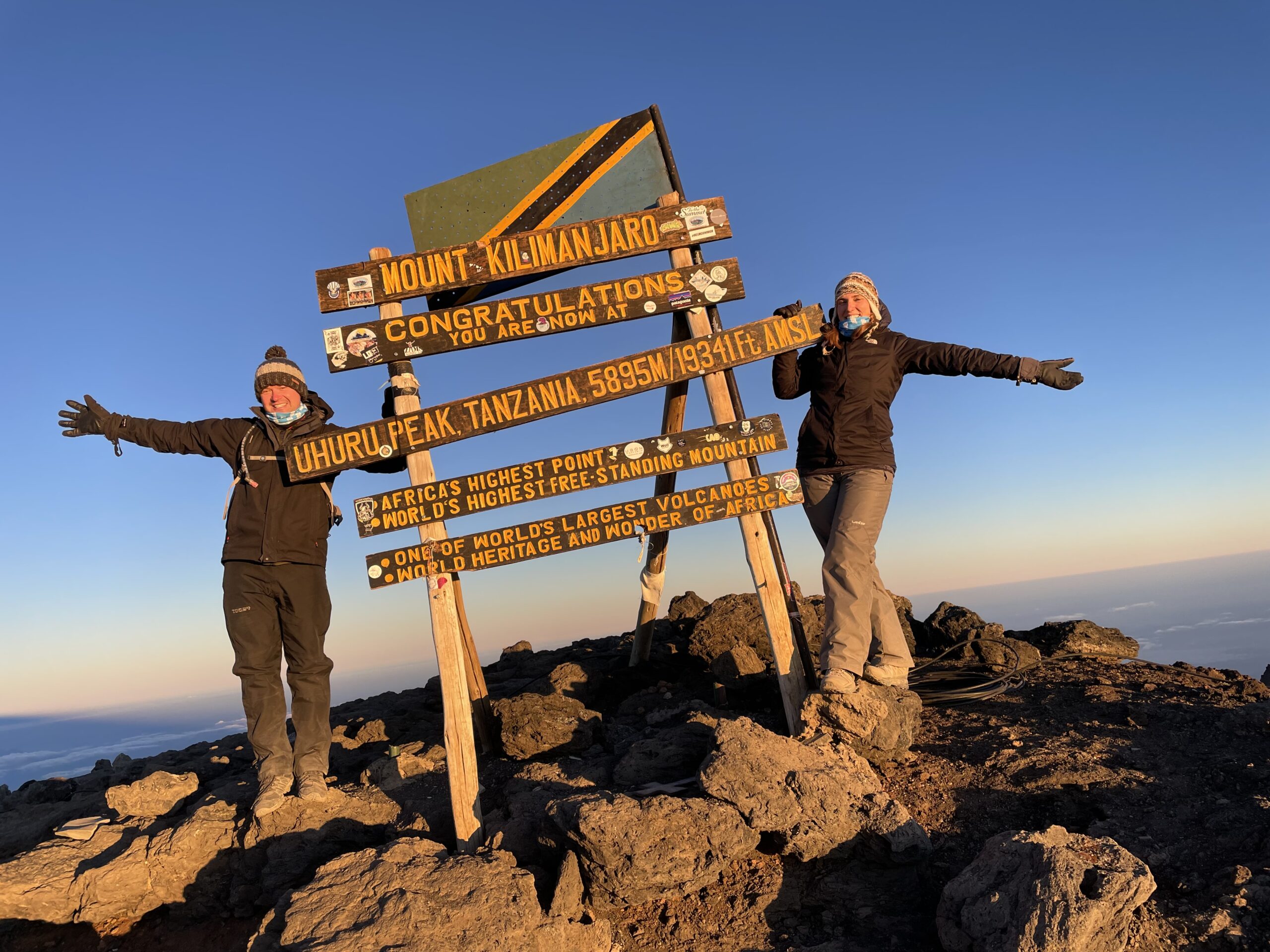
(Celebrating at the top of Kilimanjaro as sun rises over the peak)
After spending 10 minutes at the top and coaxing my wife into having some photos with the sign, the -15 windchill is taking effect and we have to leave. As we descend we come across a lady, I’d guess aged below 30, being supported by two people up the last stretch of the mountain. She’s in a very bad way, barely able to support her own weight and her eyes are rolling back in her head. I stop and look alarmed at her as they pass. I’m assured by her carriers that she’ll make it to the top and she’ll be fine, but if I knew her I’d have started taking her down a long time before. As we walk on I look out over the barren landscape ahead of me. It’s truly one of the most incredible moments of my life, filled with an amazing sense of achievement but in complete awe of the landscape before me. The desolation, the sun rising, the glacier off to my right and the barren Kilimanjaro crater to my left. The emotion is so intense that I shed a couple of tears, which catches me completely off guard. It’s an experience of a lifetime that I’ll never forget.
The descent is rapid on a scree slope of fine dolomite sand. It’s a different route to the one we took up. It’s a soft powder and feels like you’re stepping into snow. As we drop down to Summit Camp we pass some guides with two Chinese climbers that are sitting looking exhausted. As we move past, our guide translates that they’ve summited successfully but have decided to call for a helicopter to pick them up, costing $2000 per person. They are not ill, they just don’t want to go any further. It’s understandable, but if I did the same I wouldn’t be able to avoid feeling like I’d somehow cheated.
We descend further to Barafu Base Camp, it’s a gruelling and dusty 1300m drop in elevation in less than 90 minutes. Two months before, we climbed Ben Nevis in Scotland, which is approximately 1300m, and we descended that a lot slower than this. We take a break at base camp for an hour before we have to continue the descent. After an hour hiking downhill we see another climber on emergency oxygen being supported by three guides, he tries to walk but stumbles with each step. As we descend further we see the ‘state-of-the-art’ alternative to the helicopter, consisting of metal gurneys with a single central wheel. It’s reminiscent of a wheelbarrow with a flat metal bed on top and looks more suited to carrying bread than a human. These were the only way to get people down until relatively recently. It’s a startling reminder of the dangers of the mountain. As we pass the guerneys our lead guide explains that a few years before she had a client that had a heart attack on the ascent, dying almost instantly. She explains that she’s had to use the emergency oxygen multiple times on previous trips. The dangers of Kilimanjaro should not be underestimated.
We finally descend down to Mweka Hut Camp, it’s a huge transition from alpine desert, through moorland and down into mountain forest. It feels strange to have grass underfoot. We finally collapse into our tent at an elevation of 3100m after descending 11km from base camp in 4 hours. We’ve travelled 17km and dropped 2800m since leaving the summit at around 7am in the morning.
Day 8
At 5am the next morning we’re woken by the adjacent campers playing music, thanks guys. We start hiking down towards the exit gate, it’s 10km and 1300m down to an elevation of 1800m. It sounds easy, but it’s muddy and the path is slippery. The centre of the track has a single fresh line of tyre tracks down the middle. The condition of the guy we saw yesterday struggling to walk worsened during the night. He had to be transported off the mountain using one of the old metal gurneys overnight.
Our legs are weak and our knees are hurting, but eventually we make it down through the beautiful mountain rainforest, with large Prunus Africanus trees covered in moss and lichen. As we drop into the clouds everything becomes shrouded in a fine mist which provides a welcome coolness after so many days in arid high altitude air. After 3 hours we reach Mweka Gate and collapse in a heap whilst the guides arrange our completion certificates. Mine is printed with the wrong age, claiming I’m already 40, but who cares. We travel 5 minutes by bus for lunch and a ‘tipping ceremony’ where our porters and guides sing and dance to celebrate our successful completion of the climb, or perhaps the tips, or maybe both, but either way it’s a joyous occasion that finally marks the end of our trip.
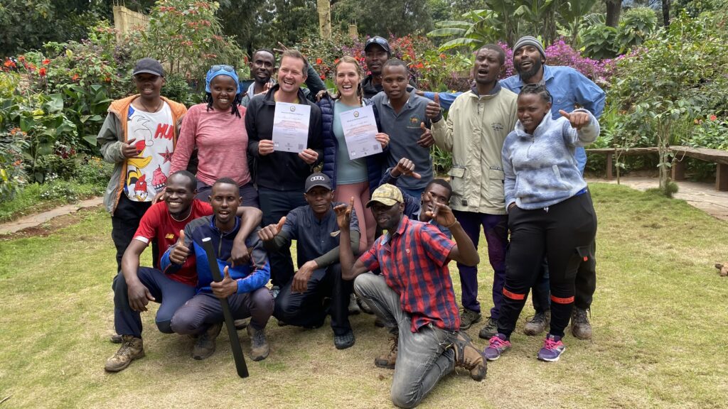
(We receive our certificates at the tipping ceremony on the final day of our trip)
We drive three hours back to Arusha, stopping briefly to get some pictures of the mountain from a distance and dropping some porters off near their houses along the way. Once we’re back we enjoy a hot shower for the first time in 8 days and collapse into bed. We spend the next 24 hours nursing our aching muscles, sorting our laundry and, importantly, we go back to the massage parlour. The next day we board a small plane over to Zanzibar. It doesn’t climb higher than the peak we’ve just summitted.
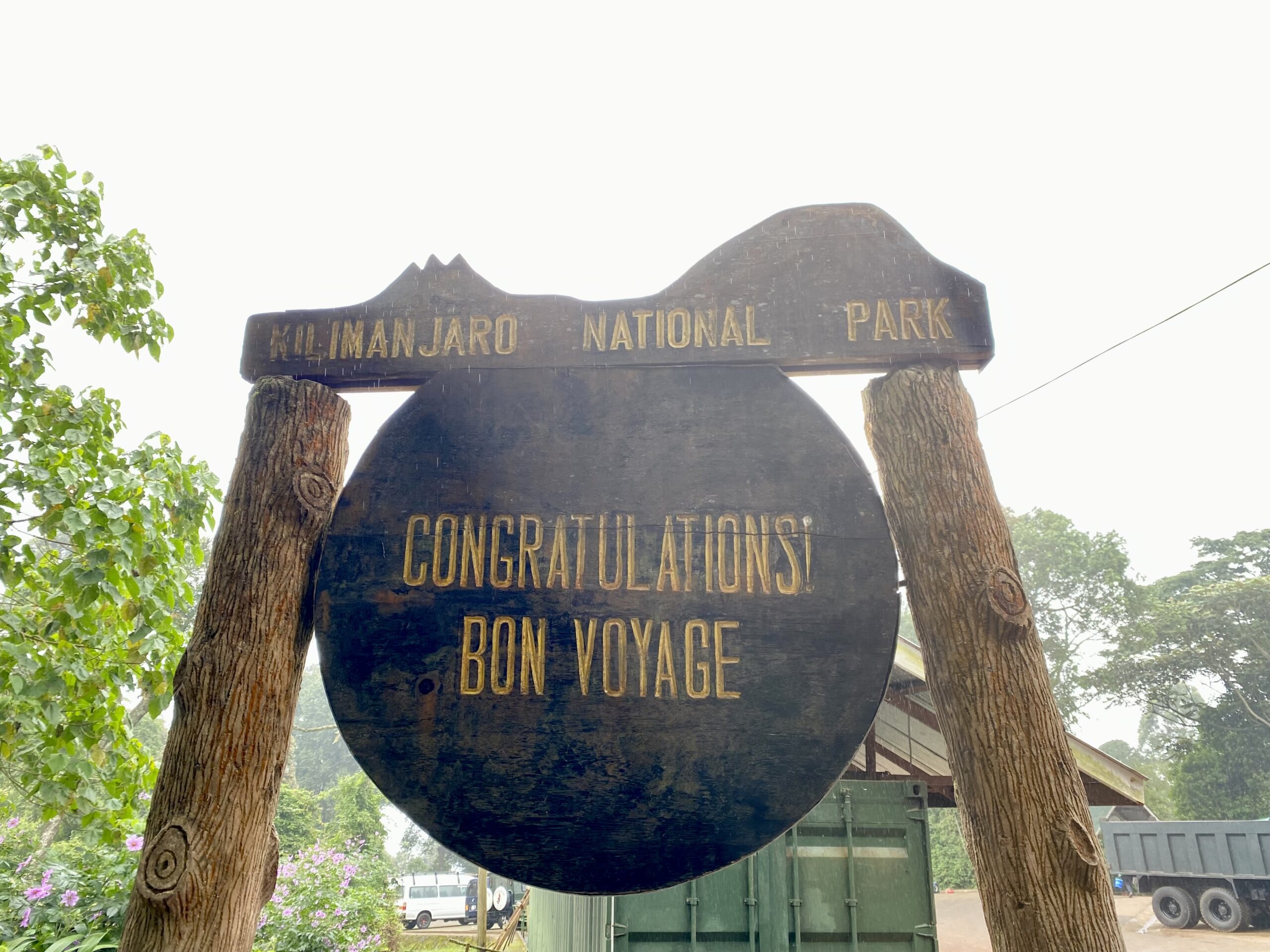
(Image above: leaving sign at the end of the trek)
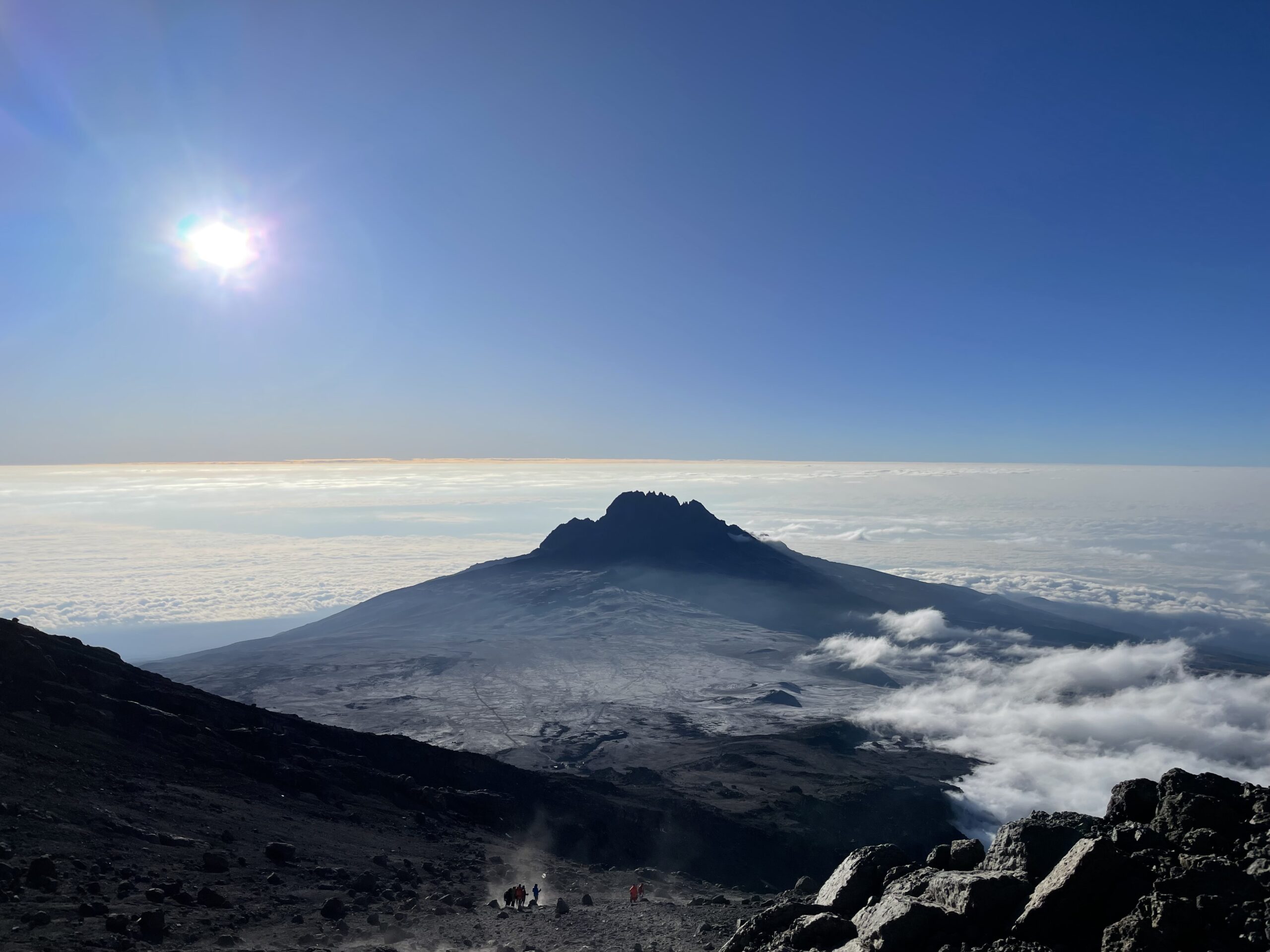
Image at top of page: view from the top of Mount Kilimanjaro after sunrise